Time to learn about maps
I decided it’s time to learn how to read a map. I’ve spent far too much time relying on others to tell me which direction to go and it’s holding back the adventurer inside me.
Luckily I happen to have an expert as a neighbour, so I decided to signed up for a two day orienteering course which took place on Dartmoor with my wife and a group of close friends. It was fun, educational and an eye opener.
“Map reading is simple right? …well kind of”
Learning the basics
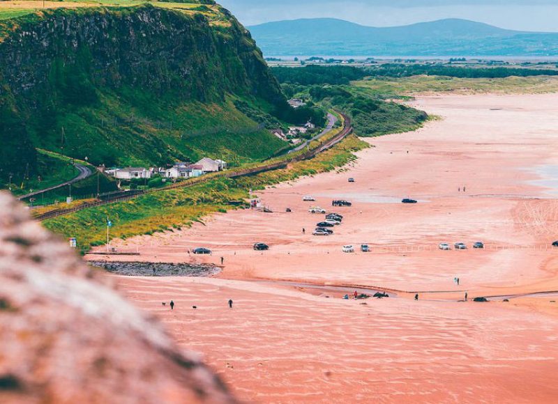
We started our first day at Bellever Forest which is a stunning little spot in Dartmoor. To be honest, there are many spots on Dartmoor like this, that’s why it’s such a popular place for people looking to wild camp, hike and generally head off on a weekend adventure.
It was here that we learned the basics about map reading – from grid references, boundaries, gradients, compass reading to understanding elevation and ground conditions – we also measured our individual strides over 100 metres which becomes very useful when plotting routes over set distances. It was all really interesting.

After a short lunch break we headed out to put our new skills to the test on a loop of the surrounding moorland. We repeatedly set markers to reach, measured by our strides. For example we would head towards a rock formation displayed on the map, after taking a compass reading and measuring the distance we would set off counting our steps knowing how many strides would equal 100 metres and as expected, we would be within a few strides from our target each time. It was very rewarding and reassuring.

Always be prepared
Our second day of training started at Meldon Viaduct, somewhere I’ve actually been before. It’s pretty cool – checkout this little video I made a while ago! It will actually give you a very good idea of how the Dartmoor weather can change – it’s almost got its own weather system, one minute it’s sunny and the next you’re in thick fog / mist and rain.
Our training today would involve a hike to the highest point in Southern England, ‘High Willhayes’ via ‘Yes Tor’ which is Dartmoor’s Second Highest Tor. At a different point in the day each couple would take charge of the navigation (no pressure then) under the watchful eye of our instructor Tom.
At different stages of the day Tom would teach us techniques that are potentially life saving if weather conditions catch you unawares and visibility suddenly becomes an issue. First was the Leapfrog method which does exactly as it says. The first person heads off in a straight line while being guided by a second person (me) to keep them on a compass bearing. When they have been guided around 50 feet they’re told to stop, I then walk past them on the same bearing, effectively leapfrogging them and becoming the person now being guided, you continue this leapfrog process until you reach your target.
We learned about a method which I can only imagine resembles a police search line, your group all stand in a line and spread out far enough to be heard and seen, then as a group you all move forward, keeping the line of communication open at all times, when one of the group stumbles across the intended destination you all then re-group with that person.
If you want to know more about map reading, navigation techniques or reading a compass, don’t ask me… I’m a newbie finding my way, ask a pro or take a course, it’s safer for everyone that way. 🙂